Walking Back Into Life — Troisvierges → Clervaux → Drauffelt (CFL1 & CFL3) with the GalgoTrio
Some journeys begin long before you lace your shoes.
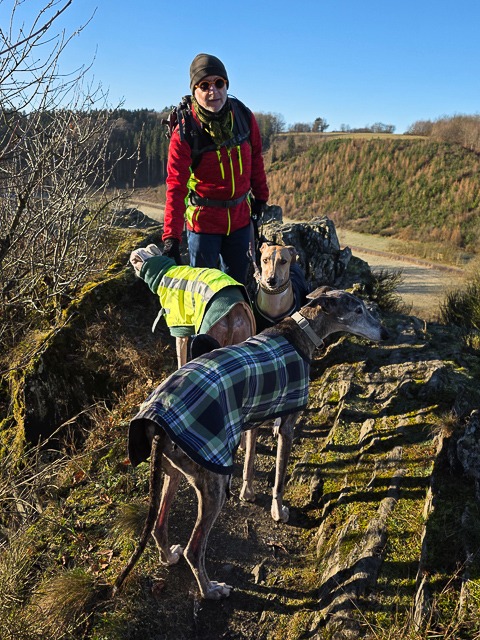
This winter walk felt special for us. Earlier this year, Serge recovered from a stroke, and in July I had my hip replacement. Ending the year back on the trails was quiet — but meaningful.
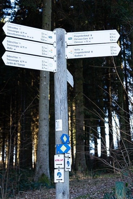
Start: Train to Troisvierges
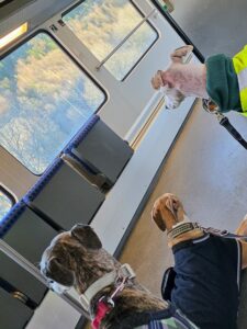
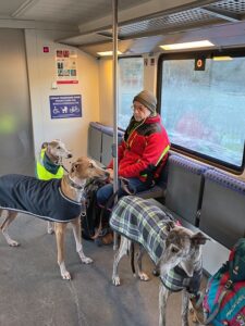
We began in Drauffelt and took the train north to Troisvierges.
Troisvierges lies near the Belgian border and has long been an important railway hub. In August 1914, German troops crossed into Luxembourg here — the first military act against Luxembourg in World War I.
During World War II, the town again became strategically important: the Germans used the railway lines to move troops and supplies across the Ardennes, and in the winter of 1944 it lay close to the fighting during the Battle of the Bulge.
Today, Troivièrges is a peaceful gateway for hikers, cyclists, and nature lovers, and the starting point for many beautiful routes through northern Luxembourg.
First meters — rocky viewpoint

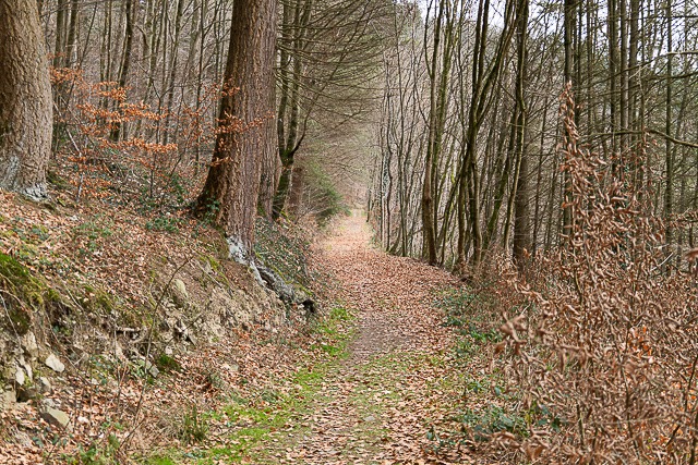
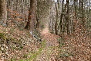
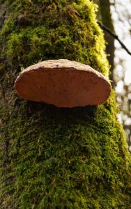
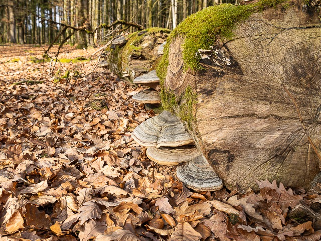
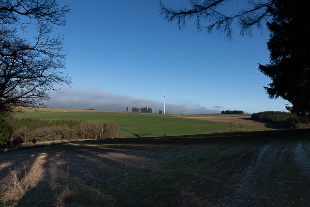
Into the forest — CFL Trail 1
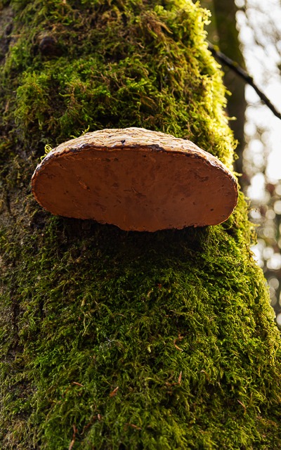
As soon as the trail leaves Troisvierges, it dives into peaceful woodland. Here, CFL Trail 1 follows former trade and farm paths, now lined with moss, fallen leaves, and forest fungi — gentle reminders of how people once travelled between the villages of the Ardennes.
Cinqfontaines — memory in the landscape
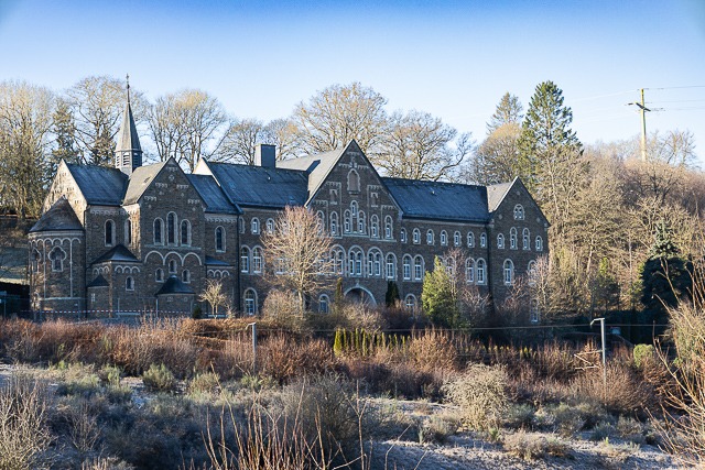
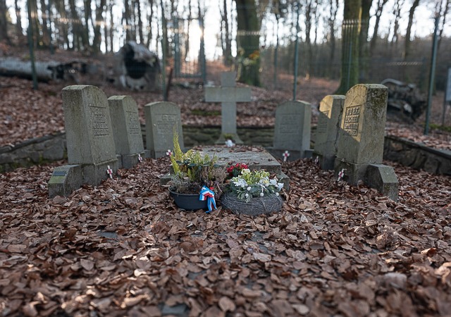
A little further along the route, the path passes close to the former monastery of Cinqfontaines, quietly set apart from the surrounding landscape. At first glance it looks peaceful — almost serene. But its history is one of the darkest moments in Luxembourg’s past.
Originally built in the early 1900s for Benedictine monks, the building was confiscated by the Nazis in 1941 and turned into an internment centre for Luxembourg’s Jewish population. Around 300 men, women and children were brought here, held against their will and later deported to the east. Only very few ever returned.
Today, Cinqfontaines has become a place of remembrance and learning. Schools and youth groups visit to reflect on tolerance, democracy and the responsibility to remember.
Walking past, the forest feels quiet — but the silence carries weight.
After Cinqfontaines — “Remember Us” memorial
Here, the story shifts from buildings to the sky.
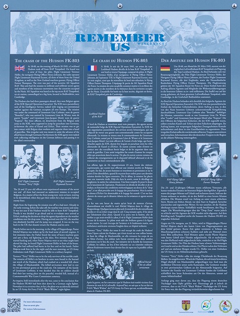
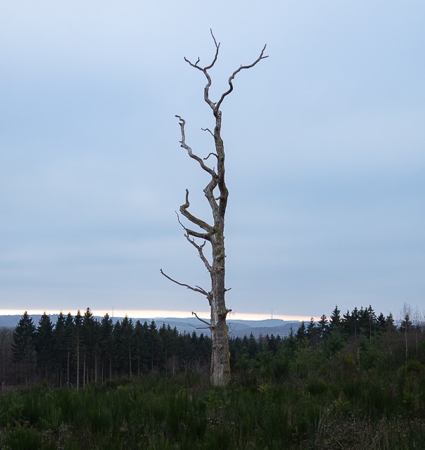
Standing there, it is hard to imagine the noise, the fear, the chaos of those days. Today, it is just quiet woodland — birds, wind, leaves on the ground. But beneath that calm lies a landscape marked by patrols, gun positions, destroyed villages and civilians who simply tried to survive.
Walking through this part of the CFL Trail adds another layer to the hike:
not only nature — but also memory, loss and the importance of remembering what happened here.
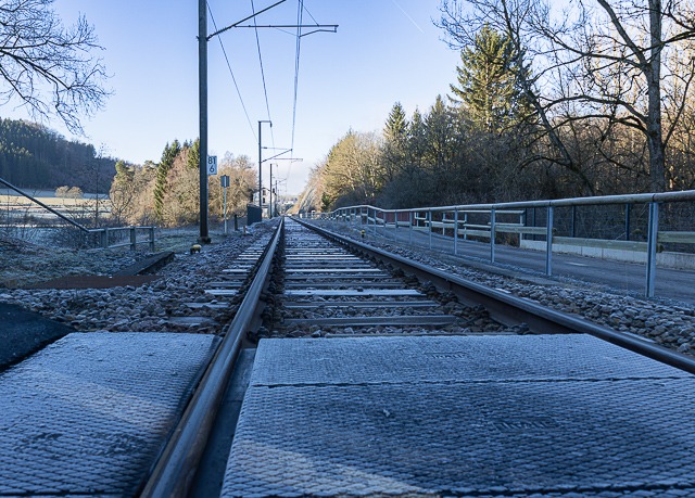
Railway & valley — approaching Clervaux
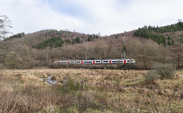
This line has long connected the far north of Luxembourg with the rest of the country and with Belgium. Over the decades it has seen almost everything: occupation, damage, repairs, and bombings during the wars.
Today, the rhythm is different. Trains carry hikers, commuters and students instead of soldiers and supplies. The sound that once meant danger now simply marks everyday life in the valley.
Walking alongside the tracks, you feel how history and present meet — quietly, almost unnoticed — before the trail finally leads toward Clervaux.
Clervaux — castle, church, abbey, and war
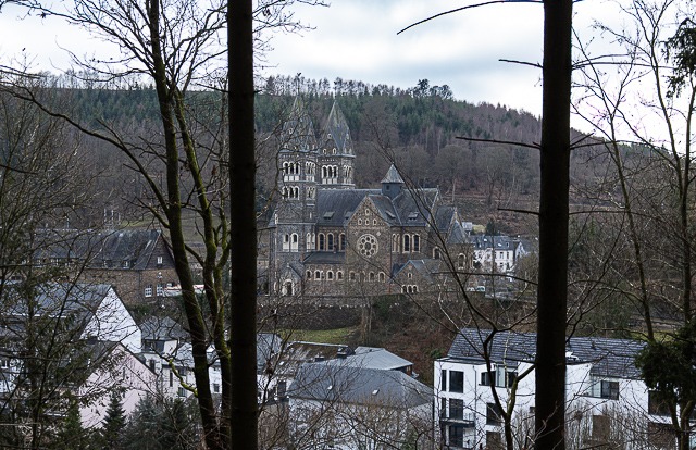
As the trail reaches Clervaux, the town slowly reveals itself between the hills. The towers of the Church of Saints Cosmas and Damian rise first — a neo-Romanesque landmark from 1910–1911 that seems to welcome hikers into the valley.
Clervaux is a place where history has left many layers.
For centuries, life gathered around the castle. Later, monasteries and agriculture shaped the rhythm of the town. And then, in December 1944, everything changed: the Battle of the Bulge brought destruction, fire and loss. Much of what you see today was rebuilt afterwards, carefully restoring life where war had passed through.
Inside the castle, history is still very present. There is a museum dedicated to the Battle of the Bulge, exhibitions on the region, and — unexpectedly — one of the world’s most famous photography collections: “The Family of Man” by Edward Steichen, now listed by UNESCO.
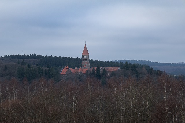
High above the town, the Benedictine Abbey of St. Maurice and St. Maur stands quietly on the ridge. Built in the early 20th century, it is still home to monks who live by a rhythm of prayer, study and craftsmanship — a calm counterpoint to the wartime stories that once filled this valley.
Loretto Chapel
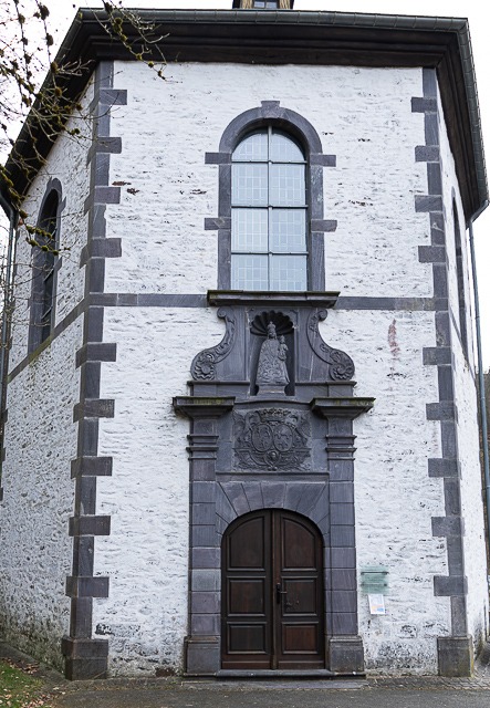
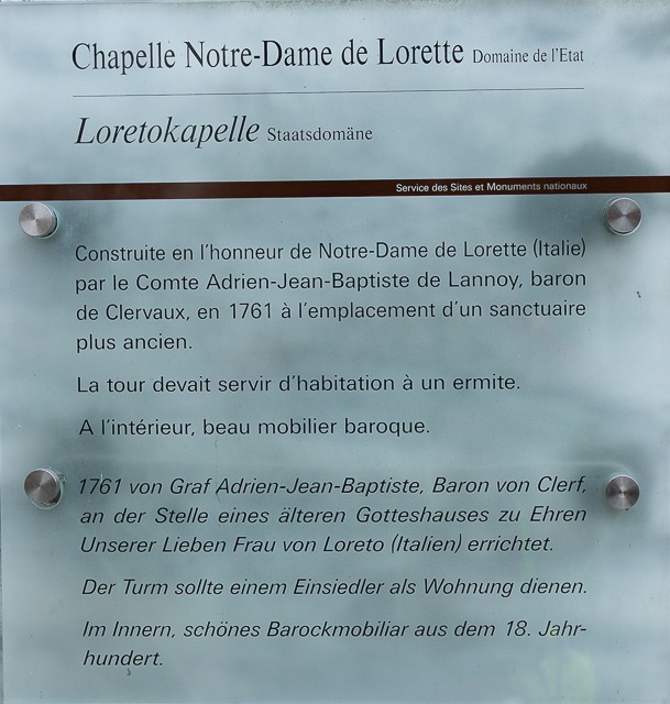
Built in 1761, it is small, simple and beautifully set among the fields — a reminder that faith once shaped daily life here just as strongly as farming or trade.
For generations, people walked up to this chapel to pray, ask for protection, or give thanks after difficult times. Pilgrims stopped here on their way through the region, lighting candles and leaving offerings. Today, it has become more of a cultural stop than an active pilgrimage site — but the atmosphere is still intimate and contemplative.
Stepping inside or simply pausing nearby, you feel the same mixture that runs through much of this hike: nature, human stories, history — all gently woven together.
Toward Drauffelt — CFL Trail 3
Leaving Clervaux, we continue on CFL Trail 3 toward Drauffelt.
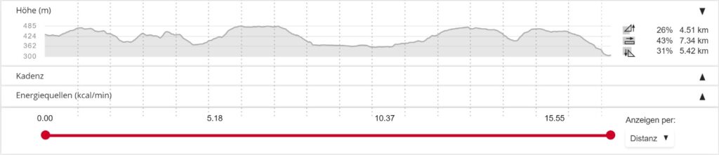
Leaving Clervaux behind, the CFL Trail 3 gently leads you toward Drauffelt — a station-to-station walk of about 6.7 km through varied terrain, so you know the train will be there waiting at either end. The route doesn’t just stick to open fields. After crossing the town and following the Clerve river valley, the trail climbs into the wooded heights of the Irbich brook valley, making its way under a soft canopy of trees before descending again toward Drauffelt.

This combination — valley floors, woodland climbs and historic routes — gives CFL Trail 3 a pleasing rhythm: moments of openness that suddenly fold into cool, leafy quiet, exactly the kind of contrast that makes walking here so memorable.eclaims everything — but human history is everywhere under the surface.
Final stretch — Drauffelt
A small village with railway roots
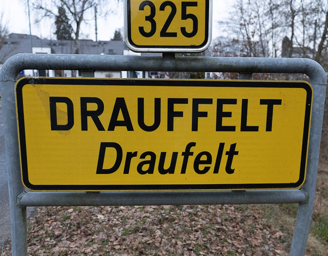
At the end of the walk, the path leads into Drauffelt, a small village shaped by the railway more than anything else.
Drauffelt sits along CFL Line 10, the main route linking the north of Luxembourg with the rest of the country. When the railway arrived in the 19th century, villages like this suddenly changed. Places that once felt remote became connected — to markets, schools, jobs and new possibilities.
Summary
This hike is not only about landscapes — it is also a walk through layers of European history:
✔️ medieval valleys and monastic routes
✔️ strategic railway corridors
✔️ WWII traces, memorials and rebuilt towns
✔️ quiet villages shaped by trains and agriculture
A route where nature, culture and memory meet — step by step.